Field record book (QdC)
All modules
Record estates and cadastral parcels
Field record book (QdC) · 3 of 15 · 6 min read
Estates group plots by farm or geographical group of farm plots. Cadastral parcels record land with cadastral data. From these two pages you create, edit, and delete farms and parcels, and see which plots belong to them.
Note: these screens currently use Italian interface labels. The instructions preserve the names shown on screen; the screenshots show the same controls.
Estates and parcels: when to use them
The estate and the parcel describe the same land from two different points of view.
- The estate is a geographical grouping: a farm or geographical group of farm plots that contains multiple plots. Use it to organise the business by location and tenure, i.e. ownership or rental.
- The parcel is the legal land unit referenced by AGEA and PAC, identified by municipality, sheet, parcel, section, and subordinate. Register it when you need to document the land with its cadastral data.
- A plot can belong to an estate and include multiple parcels. It can also belong to no estate at all.
If a farm is rented, register it as an estate with tenure Affitto and indicate the owner. If a piece of land is not part of any farm, there is no need to create an estate for it.
Before you start: to create and edit estates and parcels you need the Responsabile compilazione registro or Manager QdC permission. To delete them you need the Manager QdC permission. With the Utente QdC permission you can only view the two pages.
The list of estates
The Corpi aziendali page lists the farms and geographical groups of farm plots of the business, sorted by farm number.
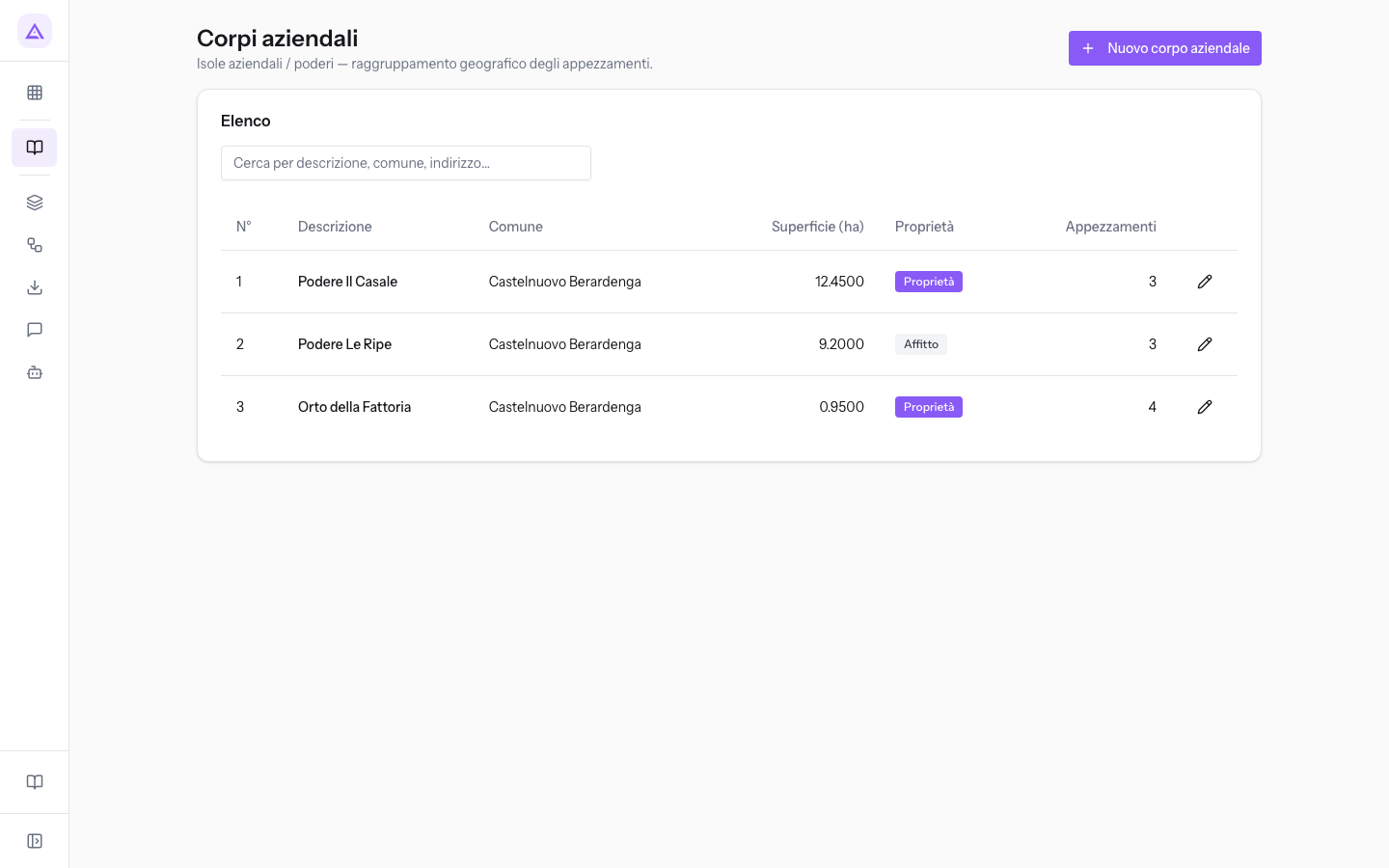
- Cerca per descrizione, comune, indirizzo…: filters the list. Searches in the description, municipality, address, and hamlet or locality.
- N°: the farm number.
- Descrizione: the name of the estate, for example Podere Il Casale.
- Comune: the municipality where it is located.
- Superficie (ha): the total area in hectares.
- Proprietà: the tenure, i.e. Property or Rental.
- Appezzamenti: the plots that belong to the estate.
To open an estate record, click on its row.
Create an estate
Every farm or geographical group of farm plots has its own record. In the demo there are Podere Il Casale owned by the farm, Podere Le Ripe rented by the farm, and Orto della Fattoria.
- On the Corpi aziendali page, click Nuovo corpo aziendale.
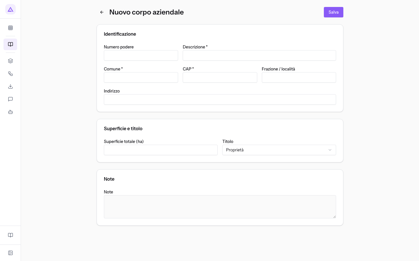
- In the Identificazione panel, fill in at least Descrizione, Comune, and CAP.
- In the Superficie e titolo panel, choose the Titolo. If you choose Affitto, the P.IVA / CF proprietario (se in affitto) field appears.
- Click Salva. You return to the estate list.
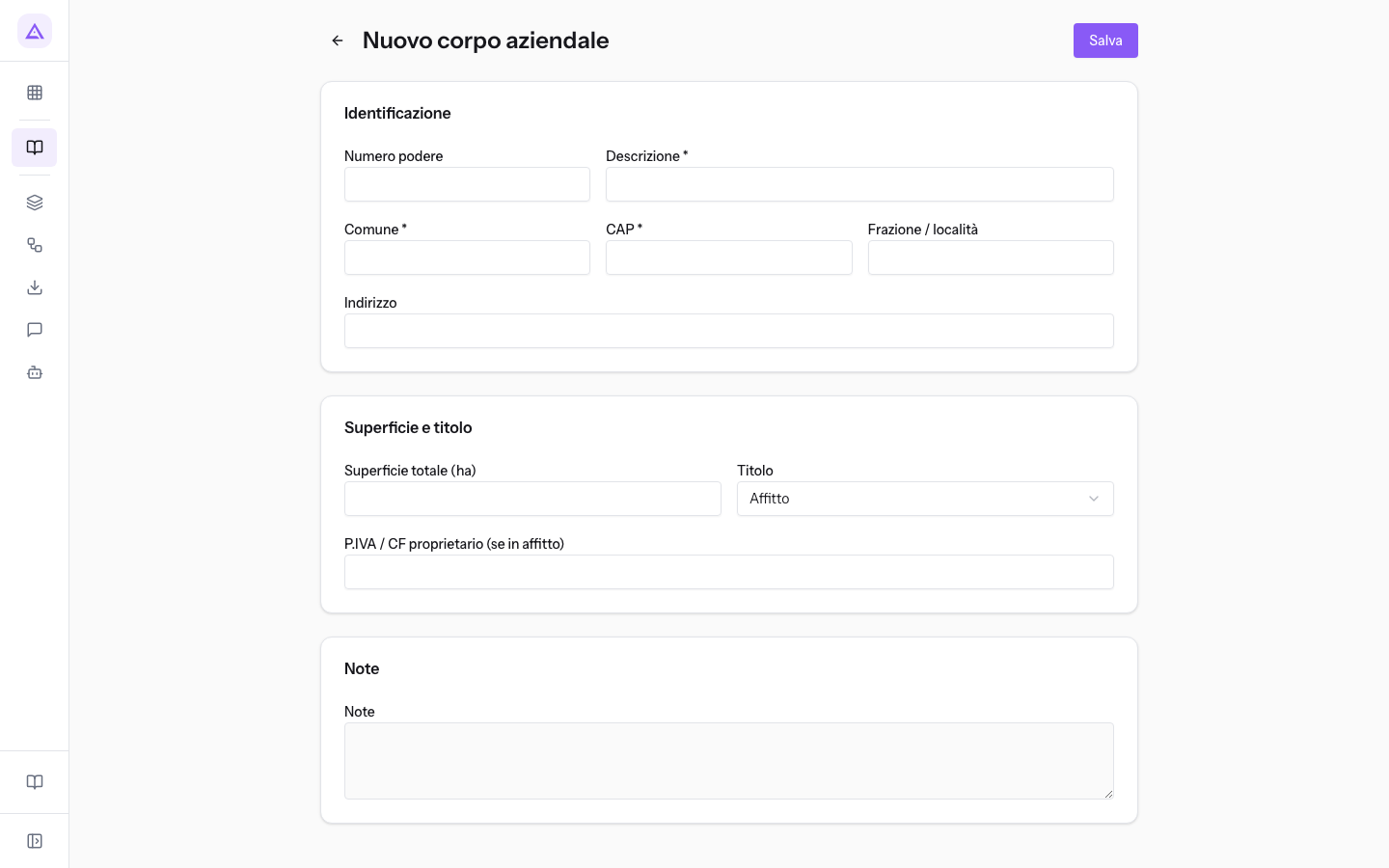
Fields in the Identificazione panel:
- Numero podere: the sequential number of the estate. Determines the order of the list. Podere Il Casale has the number 1.
- Descrizione: the name of the estate. The field is required.
- Comune: the municipality where the estate is located, for example Castelnuovo Berardenga. The field is required.
- CAP: the postal code. The field is required.
- Frazione / località: the hamlet or locality, for example Pianella.
- Indirizzo: the street and house number, for example Strada del Poggio 4.
Fields in the Superficie e titolo panel:
- Superficie totale (ha): the area of the estate in hectares, up to four decimal places. Podere Il Casale has 12.4500 hectares.
- Titolo: the tenure by which the business holds the land. The default value is Proprietà.
- Proprietà: the land belongs to the business.
- Affitto: the land is rented. Shows the owner field.
- P.IVA / CF proprietario (se in affitto): the VAT number or tax code of the landowner. Appears only with the Affitto tenure.
In the Note panel, write information that has no dedicated field, for example what is grown in the estate.
View and edit an estate
The record of an existing estate shows the same panels as when creating it and, at the bottom, the linked plots.
- On the Corpi aziendali page, click on the estate row, for example Podere Il Casale.
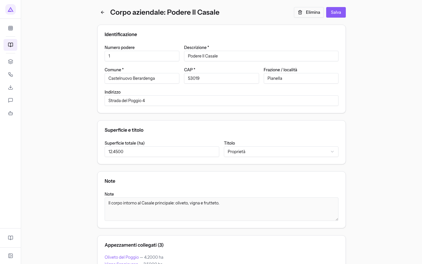
- Edit the fields you need.
- Click Salva to keep your changes.
Linked plots appear only if the estate has any. Each plot opens with a click: Podere Il Casale contains Oliveto del Poggio, Vigna Sangiovese, and Frutteto del Casale.
Note: from this record you can view the estate's plots, but you cannot add or remove them.
Delete an estate
You can delete an estate from its record using Elimina.
Important: deleting an estate does not delete its plots. They remain registered without an estate.
The list of cadastral parcels
The Catasto page lists the business's cadastral parcels, i.e. the legal land unit referenced by AGEA and PAC. In the demo there are 8 parcels from sheets 42, 43, 57, and 58.
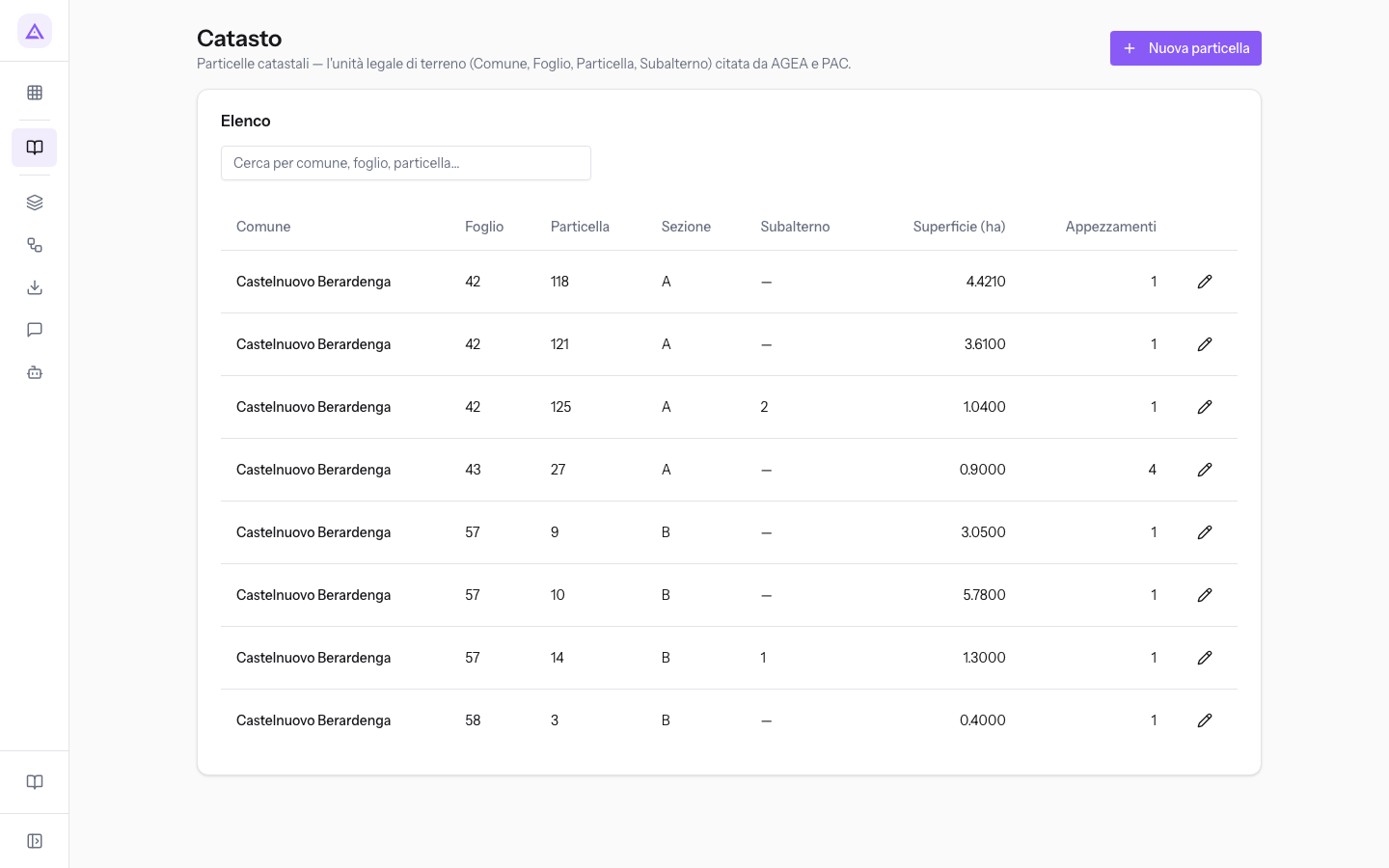
- Cerca per comune, foglio, particella…: filters the list by municipality, sheet, or parcel number.
- The Comune, Foglio, Particella, Sezione, and Subalterno columns show the cadastral data. They are followed by the area and the plots that include the parcel.
To open a parcel record, click on its row.
Register a cadastral parcel
Register a parcel for each cadastral reference of the business's land.
- On the Catasto page, click Nuova particella.
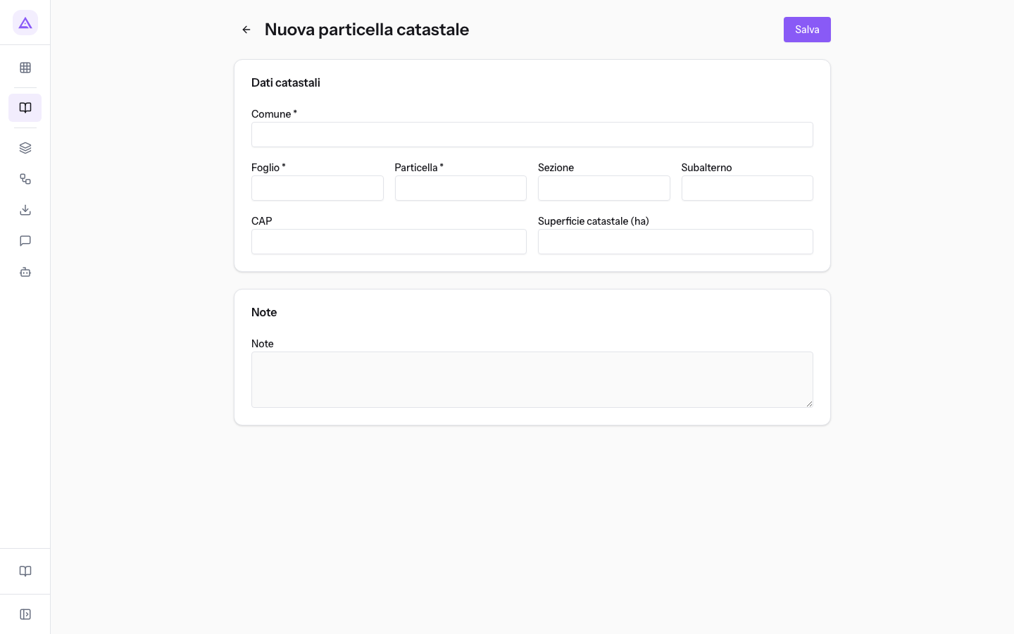
- In the Dati catastali panel, fill in at least Comune, Foglio, and Particella.
- Click Salva. You return to the parcel list.
Fields in the Dati catastali panel:
- Comune: the cadastral municipality, for example Castelnuovo Berardenga. The field is required.
- Foglio: the map sheet number. The field is required.
- Particella: the parcel number within the sheet. The field is required.
- Sezione: the cadastral section, when the municipality requires it.
- Subalterno: the sub-unit identifier (subalterno), when the parcel has one.
- CAP: the postal code.
- Superficie catastale (ha): the area recorded in the land registry, in hectares.
In the Note panel, write information that has no dedicated field.
View, edit, and delete a parcel
The record of an existing parcel has the sheet and parcel as its title, for example Foglio 42 — Part. 118.
- On the Catasto page, find the parcel using the search field and click on its row.
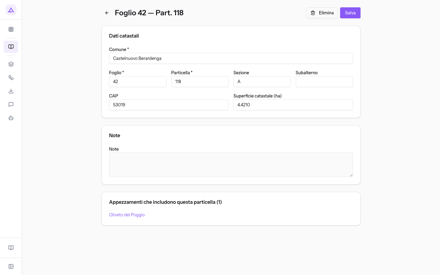
- Edit the fields you need and click Salva.
- To delete the parcel instead, use Elimina.
The Appezzamenti che includono questa particella panel shows the number and name of the plots that include the parcel. Parcel 118 on sheet 42, section A, in Castelnuovo Berardenga, has 4.4210 hectares and is part of Oliveto del Poggio.
Note: from this record you can view the plots that include the parcel, but you cannot add or remove them.
See it on your company, not on a slide deck.
In 30 minutes we map the software you use today.We show you how much work and how much margin Archimedes gives back.
Show me on my business →What industry are you in?
One tap — it lets us prepare the demo around your world.
What tools do you use today?
Pick the ones you recognise — or just type them. It helps us show you how they migrate.
Last step: your details.
We reply within one working day — and right after, if you like, you pick the demo slot yourself.
We couldn't send your request. Try again, or write to us at [email protected].
By sending, you agree to your data being processed so we can get back to you about the demo. Privacy notice.
Preview form — nothing is sent from this page.
Want to schedule the demo now?
Your call: book the slot you prefer yourself, or we'll call you to arrange it.
Live availability, 30 minutes, instant confirmation. The calendar opens in a new tab.
Lock in your slot ↗We'll get back to you within one working day — and we'll join the call already knowing your world.
The calendar is open in another tab: pick a slot and the demo is booked. Can't see it? Reopen it ↗
Preview page: nothing was sent.
Our calendar is live: take the slot that suits you and the demo is booked. 30 minutes, instant confirmation, no waiting.
Lock in your slot ↗